Translate

Friday 27 November 2015

ROOPKUND TREK

ROOP KUND TREK, A SOULFUL TREK
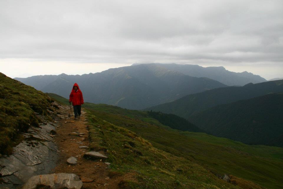
LOCATION:  UTTARAKHAND, INDIA

When it comes to RoopKund Trek, it covers everything for a travelling enthusiast Deep virgin forests, gurgling brooks, breath-taking campsites, miles of undulating meadows, snow and ice, and the taste of a great adventure as you climb from 8,000 ft to 16,000 ft in 4 days.
Your trek starts at Lohajung (7,700 ft), a tiny pass, in the heart of the greater Himalayan range, 85 kms from Karanprayag.

Trek Itinerary
Day 1: Arrival Day (Base camp – Lohajung)
  • Arrive at Kathgodam (on your own)
  • Indiahikes will arrange transport from Kathgodam to Lohajung at 6.30 am. The cost of this will have to be borne by the trekkers.
  • The journey to Lohajung will take around 11 hours.
  • After team briefing, camp over night at Lohajung.

Day 2: Lohajung to Ghaeroli Patal
  • Start the day with an hour’s drive to Wan
  • From Wan, trek for 4 hours to Gaheroli Patal.
  • The trail is a combination of steep ascents and short descents.
  • The bridge over Neel Ganga is a beautiful place to relax during the trek.
  • The second half of the trek is through lovely oak and rhododendron forests.
  • Reach Ghaeroli Patal by late noon and camp there.

Day 3: Ghaeroli Patal to Bedni Bughyal
  • Start leisurely. The day consists of just 2-3 hours of trekking.
  • The initial half hour is a steep descent through forests, at the end of which you emerge into a meadow called Ali Bughyal.
  • From Ali Bughyal, it’s a pleasant walk through acres and acres of meadows.
  • The trail switches back towards the end of the day’s trek. From here, Bedni Bughyal is an hour away.
  • It takes around 3 hours to cover around 5 km.
  • Camp over night at Bedni Bughyal.

Day 4: Bedni Bughyal to Pathar Nachauni
  • Today’s trek is an easy climb following by a gradual descent to Pathar Nachauni.
  • It takes 4 hours to cover the distance.
  • There are two routes. One requires you to trace back the previous day’s trail for ten minutes and continue on that trail. The other trail is from your campsite.
  • You can visually trace the second trail from your campsite for 3 km until it disappears into a saddle in the mountain.
  • Walk along this trail. Ghora Lotani is a good place to relax.
  • On a clear day, the view from this trail is beautiful. You’ll also begin to see the first traces of winter snow.
  • From Ghora Lotani, Pathar Nachauni is a short climb away. It is at the foot of the hill that holds the Kalu Vinayak Temple.
  • Camp at Pathar Nachauni for the night.

Day 5: Pathar Nachauni to Bhagwabhasa
  • Today’s trek will take a total of 5 hours.
  • It starts off with a flat walk, followed by a steep ascent to Kalu Vinayak Temple and then a gradual descent to Bhagwabhasa.
  • The air gets thinner by the minute, so ascend as slow as possible, to acclimatise better.
  • Just as you finish the climb from Ghora Lotani, you’ll reach Kalu Vinayak Temple, where there’s a shrine with a black idol of Lord Ganesha in it.
  • Bhagwabhasa is 2 km from here, following an easy, gradual descent.
  • There will be snow on this trail. By June, this snow might be slippery.
  • Reach Bhagwabhasa and camp there. The nights get extremely cold and windy. Keep warm clothes in handy.

Day 6: Bhagwabhasa to Roopkund, further up to Junargali and back to Pathar Nachauni
  • Today’s trek is a long and tough one. Start early at 5 am to walk on fresh snow.
  • The climb to Roopkund is a 5 km-long gradual ascent with a few steep gradients in between and in the end. It takes about 3 hours to reach Roopkund.
  • Roopkund is a crater lake at a dip in the mountain face. It is at 16,500 feet. You have to climb down 50 feet to reach the edge of the lake.
  • From Roopkund, if the weather permits, climb to Junargali.
  • Junargali is a sharp ridge line that towers over Roopkund. It’s a 20 minute climb, but on a very steep surface. You may need ropes.
  • Start your return by 9.30 am. It takes 3 hours to reach Bhagwabhasa.
  • Stop for lunch at Ghora Lotani and head down to Pathar Nachauni.
  • Camp at Pathar Nachauni for the night.

Day 7: Pathar Nachauni to Lohajung
  • Today’s trek will take around 7 hours.
  • You’ll be trekking from Pathar Nachauni all the way to Wan, and then driving for an hour to Lohajung.
  • The trek is through the meadows of Bedni Bughyal and then through the forests over Wan.
  • Watch out for a deviation from the route you took earlier. Instead of going from Bedni Bughyal to Ali Bughyal, you’ll be directly taking a right turn and entering the treeline.
  • Pause to take in the view at Ghairoli Patal, from where you get astounding views of Mt.Trishul.
  • Stop at the bridge over Neel Ganga, where you can quickly wash up.
  • From the bridge, it’s a half hour climb to Wan and a further one and a half hour’s descent to Kasar Bagad, where you meet the road.
  • Drive to Lohanjung and camp there for the night.

OTHER IMPORTANT INFORMATION:

Difficulty Moderate-Difficult. 
Trail typeCircular; returns to base camp.
AltitudeRoopkund: 15,750 feet (4,800 mts). Junargali 16,000 ft (4,878 mts, highest point)
Rail headKathgodam. You can reach Kathgodam by an overnight journey from Delhi. Ranikhet express leaves Old Delhi station at 10.40 in the night to get to Kathgodam by 6.30 in the morning. Indiahikes pick up is lined up with the Ranikhet Express.
Base CampVillage Lohajung (Chamoli District, Uttarakhand)
Best SeasonMay 3rd week to June end; Mid September to October end.
Temperature in May, JuneDay: 15° to 20°C. Night: 4° to 7°C. Temp at highest camp, Bhagwabasa: Day 5°C to 10°C. Night: 3° to -2°C.
RainsRainy season is from the second week of July to mid September. May/June is not the rainy season but afternoon showers are very common in the mountains. These are not the monsoon rains.
Temperature in Sept and OctDay: 13° to 20°C. Night: 2° to 7°C. Temp at highest camp, Bhagwabasa: Day 3°C to 10°C. Night: 3° to -4°C.
SnowHigh snow in May from Kalu Vinayak onwards. Decreases in June. Comfortable snow during the last half of June. September has little snow. In the first week of October, the first winter snow is likely to fall in the upper reaches. Usually melts in a few days.
PreparationPhysical preparation mandatory. 

THE INCA TRAIL TREK

the INCA TRAIL, machu picchu


location: peru, south america


This unforgettable Machu Picchu trek offers a cultural and physical journey through Peru’s Urubamba Valley along the renowned Inca Trail, traversing the very same paths once walked by the citizens of this ancient empire. Over the course of your challenging 26-mile (42-km), 4-day hike, you’ll experience fascinating ruins, incredible Andean scenery and the unique flora and fauna of Peru, culminating with your arrival at the incredible mountain stronghold of Machu Picchu.

Leading you on your journey is a knowledgeable guide, who will share stories about Inca culture and provide historical context. You’ll also be accompanied by porters to help carry tents and sleeping gear, cook meals, and set up camp each night. The ratio of trekkers to guides and porters is kept low, with one guide for every four trekkers and one porter for every two people on the trek.

It is recommended that you book well in advance, as the required permits to visit Machu Picchu are limited to just 500 people per day by the Peruvian government.

Day 1 
Distance: 
7.45 miles / 12km
Estimated time: 
5-6 hours
Maximum altitude: 
9,850 feet / 3,000m
Campsite: 
Huayllabamba

Early in the morning, you'll depart to Piskacuchu, a community located on the 82nd km (51 mile) of the Cusco - Machu Picchu railroad. From this point, you'll cross the bridge, walking along the shore of the Urubamba River as it flows north-west along the Sacred Valley. Following the trail along a flat terrain you'll arrive in Miskay before ascending to the tallest part of the overlook, the Inca city of Patallacta.

You'll continue trekking along the valley created by the Kusichaca River, gradually climbing for about 5 hours until we reach the first campsite at the village of Wayllabamba. All along the way, you'll enjoy spectacular views of the Vilcanota ridge on the opposite side of the Urubamba River where the impressive Veronica peak reigns at 19,100 feet (5832m) above sea level. Also, you'll enjoy the diversity of wild flora and fauna found all along the valley.

Day 2 Distance: 6.83 miles / 11km
Estimated time: 
6 - 7hours
Maximum altitude: 
13,799 feet / 4,200m
Campsite: 
Pacaymayo

After breakfast, the adventure continues. Surrounded by vegetation, you'll ascend and be exposed to the different ecological levels of Peru. Upon arrival at Warmiwanusqa, the highest point of the trip at 13,800 feet (4200m), you'll see the majestic peak of the snow-covered mountain Huayanay which stands at 17,225 feet (5250m).

You'll pass domesticated llamas and alpacas grazing on ichu, one of the few plants that grow at this high altitude. Cross an area of cloud forest, home to a variety of birds (like hummingbirds and sparrows) and the Andean bear.

It is highly recommended that on this day, your day pack is well stocked with candy, chocolate and coca leaves that will keep your sugar level high and help with potential altitude sickness. Immediately after the pass, you'll descend into the Pacaymayo valley, where you'll camp with a spectacular view of snow-covered mountains.

Day 3 Distance: 9.93 miles / 16km
Estimated time: 
8 hours
Maximum altitude: 
12,664 feet / 3,860m
Campsite: 
Winaymayna
Today, you'll visit the ruins of Runkurakay and enjoy spectacular views of the waterfalls on the snow-covered mountain Palcay. Trekking along, you'll enjoy panoramic views of the Mountain Range of Vilcabamba and its most important peaks, Pumasillo, Sacsarayoc and Panta. From this area, you'll start a slow descent, crossing the ruins of Sayajmarca, which are still covered with vegetation. On the way down, you'll go through a tunnel formed by a soil slide adapted by the Incas. Keep going until you reach the ceremonial center of Phuyupatamarca where you'll stop for lunch. From here, descend to ruins of Winay Wayna and camp near a hostel for to enjoy hot shower.
Day 4Distance: 2.48 miles / 4km
Estimated time: 
2 hours
Maximum altitude: 
8,923 feet / 2,720m

Early in the morning, you'll continue the adventure and head to the Sun Gate (Intipunku). Here, enjoy an incomparable view of Machu Picchu which few people get to experience. You are now just 40 minutes away from the city. Descend to Machu Picchu and enjoy a guided visit of the sacred citadel. After, you'll take the bus down to the town of Aguas Calientes where you'll catch the train for the return ride to Cusco.

Other Important Information:

It can often be confusing when it comes down to how the various Inca archeological sites are spelled. Most of the sites of interest have been given Quechua names. Quechua was the official language of the Inca civilization and still spoken by more than 7 million people (mainly in the Andean highlands of Peru, Ecuador and Bolivia). However the language was a spoken language was never written down by the Incas. In modern times various people have tried to produce an official Quechua dictionary but so far have not succeeded. There are therefore many interpretations when it comes to how each place name is spelled. Even Cusco can be spelled 3 ways: Cusco, Cuzco or Q'osqo!! The letters c, k & q are frequently interchanged as are w, hu & ll.

QILA LAL KOT TREK

A decent trek in the heart of Delhi

LOCATION: MEHRAULI, NEW DELHI


Delhi is a city that is overflowing with history. With its numerous monuments, it takes one back to long-gone eras, something that few other cities can boast of doing. Qila Lal Kot is one of those monuments. Situated in the lovely forests of Sanjay Van in Mehrauli, this 12th century fort offers a refreshing break from the daily grind. It’s apt for family picnics, as its fit for people of all ages. 
The Qila Lal Kot is a wall that was built around the first city of Delhi when it was established in the 8th century by Tomar Rajputs. Later, the Chauhans added to the fortification in the 12th century, the ruins of which are seen to this date. “Qila” means fort or castle in Persian.
The trail to the fort is well-marked and runs in a circular manner inside the forest. It’s a welcome change for nature and history lovers. As you climb up, you can see the tall Qutub Minar towering over the keekar leaves. The feeling of getting away from the dirt and chaos of the city is enormous when you get to the top of the fort. All around you, forests stretch for as far as your eyes can see. The far boundary is speckled with small buildings, and the Qutub Minar stands bang in the middle of the forest. It’s solitude like you’ve never experienced before. 

How to do the Trek

  • Time taken: 2-3 hours, 6 km
The trek to Qila Lal Kot has multiple entry points. The prominent one starts from Gate No. 5 of Sanjay Van, 100 metres away from Qutub Minar Complex in Mehrauli. After walking for a couple of minutes, spot a pond on the left. Soon after this pond, you’ll see a guide map on the right, which indicates different trails in the forest. Locate Qila Lal Kot on this map and follow the marked trail.
The trail is wide for around 300 metres, after which it bifurcates into two. Take the trail on the left. The right turn is a good turn to take if you want to explore the forest, but it does not lead to Qila Lal Kot. You’ll have to come back to the same junction to head to the fort. Throughout the forest, there are medicinal plants, which have signboards describing them. 
The narrow pathway now enters the forest. Soon, you’ll see a stairway, which marks the beginning of Qila Lal Kot. You’ll see ruins of the fort around you for over half a kilometre. You’ll reach the top of the fort in no time. Enjoy the other side of Delhi, with fresh air and cool breeze from the forest.
There are two trails that run from the top of the fort. The one on the right extends to century-old ruins and then enters into dense forests. The left trail is first a neat muddy path, then becomes rocky and ends up inside a part of the forest that is full of thorny shrubs. It takes you to the back of a dargah (Islamic shrine). Take the left trail.
Cross the dargah and walk further through the thorny bushes. Look for a trail going inside the forest. It is exactly opposite to a well near the dargah. If you can’t spot it, you can ask around for directions to the lakes.
This trail stretches in a straight line, passing through dense forests. After about 15-20 minutes, the trail meets a wider trail. Follow it to reach a park inside the forest. The path to Neela Hauz (pond) from inside the forest is closed, but you can reach the pond by exiting from the ICGEB gate and then turning left and continuing on the road for about 50 metres. Make note that the pond is no more “neela” (blue) because of some constructions.
From this pond, you can take an auto to either Qutub Minar or Chhatarpur metro station. Alternatively, you can also trace back the trail to get to the start of Sanjay Van and visit Qutub Minar.

Thursday 26 November 2015

TRIUND TREK

Triund Trek

LOCATION: MCKLEODGANJ, HIMACHAL PRADESH, INDIA


Trek alongside rhododendrons and oaks, and camp in a cave

Located 18 km from Dharmshala, Triund makes for an attractive trekking destination, with well-defined forest trails and breath-taking views of the entire Kangra valley. The view of the evening sky from Triund is a good enough reason to pitch a tent here for the night. The length of the trek makes it apt for a weekend.
Although the trek from McLeodganj to Triund is a steep ascent of over 1,100 metres, it is well-compensated by refreshing walks amongst rhododendron and oak trees. There is no dearth of eating options as there are several cafes on the way, like Magic View, Scenic View and Snowline CafĂ©.
The town of McLeodganj (also known as little Lhasa) provides for a grand opportunity to experience the vibrant Tibetan culture. The trekking scene here is well-organised and one can embark on multiple treks of longer duration here, namely Indrahar Pass, Minkiani Pass, Kareri Lake and all the way to Kuarsi Pass and Mani-Mahesh. If you have a day to spare, fancy trekking from Triund till Lahesh Cave and explore the meadows below Indrahar Pass. 

Trek Description

This is a small and an easy trek, which can be done either from McLeodganj or Dharamkot, which is 2 km ahead of McLeodganj. The trail is 7 km from Dharamkot and passes Galu Devi temple. From this temple, it takes around 3 hours to reach Triund. The initial half of the trek is a gradual incline and the last 2 km from Snowline CafĂ© involve a steep climb all the way till Triund (2,975 metres).  

How to reach McLeodgang

Reach Dharamshala which is a major town, 9 km before McLeodganj via overnight bus from New Delhi. Himachal Roadways and Himachal Tourism have regular bus services from Kashmiri Gate ISBT Delhi from 5 pm onwards. One can travel in Volvo bus and book tickets online at:
  1.  http://www.hrtc.gov.in/hrtctickets/
  2.  http://hp.gov.in/hptdc/Common/Register.aspx     
From Dharamshala, there are regular local buses to McLeodganj every half hour, plying from 7 am to 8 pm. You can also take a shared cab to McLeodganj or Dharamkot. 

How to do the trek

Day 1: Bhagsu/Dharamkot to Triund via Galu Devta:

  • Altitude: 6,184 ft to 9,760 ft
  • Distance: 7 km
  • Time taken: 3 hours
Bhagsu and Dharamkot are two villages situated about 2 km up the ridge from McLeodganj. Both of them can be considered road heads. The trail from Dharamkot is arguably the nicer one as it climbs through the thick crown of pine forests above the village. Walk up through the forest for about 15 minutes before you get to the Galu temple clearing. 
There’s a small tea shop here, just below the shrine. From here, one trail goes south-west into the forest to the village of Naddi. Another forest trail goes north-west, to the stream that descends from Laka. The main trail to Triund continues straight past the small shrine. The trail is a gently rising one, through oak thickets and traverses the steep side of the Laka ridge, following its contour. Dharamkot and Bhagsu lie directly below this trail.
Approximately halfway up the trail is a deep gully that traverses a steep section and emerges on a rocky spur. The main Dhauladhar range, which passes out of view as you ascend from Dharamkot, swings into view here. The pyramidal peak of Mon appearing larger than life.
This entire stretch is perfect for birdwatchers, as the forests here are literally swarming with various kinds of songbirds. Past the Magic View CafĂ©, the trail gets steeper. At this point, the Dharamkot spur of the Laka ridge meets the Triund ridge at right angles, creating a series of steep gullies that end up in thickly wooded chasms. 
The trail continues through a series of steep switchbacks. It climbs the Triund ridge through dense thickets of rhododendron and oak trees. It’s a pleasant, if slightly strenuous climb from here to Triund in good weather. Watch your step when it’s raining, as the path turns into mush.
The last couple of switchbacks bring you out of the rhododendrons and out onto the Triund ridge. It’s an open grassy ridge that stretches a good kilometre to the south, before plunging into the Kangra valley. There are plenty of places to camp. You could even get some provisions at the four tea shops here.
From Triund, marvel the immaculate views of Dhauladhar ranges, namely Mun (4,610 m), Rifle Horn, Arthur’s seat & Slab (4,570 m). Water is scarce and is available some 1 km before Triund.

It is highly advisable to carry your own supply of drinking water up here. Forest rest house is the only option for night stay at Triund. Advance booking is required and can be done at Dharamshala. It is advisable to carry your own tent and sleeping bag here. During trekking season you will have presence of dhabas at Triund where you can get a cooked meal and refreshments. 

Day 2 (Optional): Triund – Laka – Lahesh cave – Dharamkot


  • Altitude: 9,760 ft to 11,646 ft
  • Distance: 25 km
  • Time taken: 6-7 hours

Start early today as there is lot of trekking involved. The trail goes north, up the Triund ridge, past the forest guest house and a small Devi shrine.
The ridge begins to rise in a very typical Dhauladhar way of cascading boulders. The trail keeps up with the Chauran nala chasm to the right, rising through more rhododendron and oak thickets and the occasional grassy ledge. The Gaddis maintain the stone trail here very well, as it goes past a couple of shrines. As the the range looms into view, the trail veers to the east and starts a steep traverse to get to the top of the Laka ridge.
The views from here are magnificent. To the east, the Dhauladhar ridge rises in a series of peaks, the most prominent of which goes by the local name of Narwana. Below, lie the green grassy ridges of Triund and just beside the trail are deep wooded chasms through which run the various streams that drain the southern face of the Dhauladhar.
Past the steep incline, the path enters rolling pastures and reaches the camping ground of Laka. This marks the uppermost portion of the Dhauladhar foothills. The upper main ridge of the Dhauladhar looms above the little bowl of Laka to the North East, with Mon dominating the scene.
A number of deep boulder fields descend the face of the ridge to Laka. The true trail to Lahesh cave and Indrahar goes up the northernmost boulder field. It is extremely important that you do not take the wrong path as it’s very easy to get lost in the maze of the upper boulder fields. There’s a small tea shop, where you could take a breather before continuing.
The trail crosses two boulder fields, usually laden with snow in May, June and again in October. At other times, you’ll have to ford the shallow, but quick-flowing streams that go down them and start climbing up the steep, boulder-filled mountain side. The upper sections of the range rise up in gigantic, tiered bounds of striated rocks that loom over the trail like some gigantic medieval castle.
The shepherds have installed an ingenious system of cairns to guide the way through this steep maze. For orientation, stick close to the true right of the stream and continue up the rib of the rock-face. After about an hour’s strenuous climbing, you’ll arrive at Lahesh cave, which is basically a long and deep fissure in a wedge between two huge boulders. It’s a nice and dry camping spot, as long as you quickly get used to the fact that you won’t ever have the space to do anything but squat on your haunches when you’re in the cave.
The natural courtyard in front of the cave commands a great view of the lower ridges of the Dhauladhar and the Kangra valley. The rock-face around the cave is pretty steep, although, during monsoon, you’ll find thousands of alpine flowers blooming on small grassy ridges.
Locating the cave can be tricky, as there are multiple caves in the vicinity. If not travelling with a guide, make sure to tag along experienced trekkers to find the way.
To go back, retrace the route you took to reach Lahesh cave, all the way back to Dharamkot. An all descending trail allows trekking quickly and covering distance in lesser time.